top of page
Skymata
Your third eye from the sky
Home
Blog
More
Use tab to navigate through the menu items.
Recent Posts
Bathymetry Mapping with SeaFloor HydroLite Single Beam Sonar
Collecting LiDAR (Riegl mini-VUX) and Imagery using DJI M600 Pro
Collecting LiDAR (Riegl VUX240) and Airborne Imagery (PhaseOne) with Manned Helicopter
Archive
September 2020
(3)
3 posts
May 2020
(1)
1 post
November 2019
(1)
1 post
September 2019
(1)
1 post
May 2018
(1)
1 post
November 2017
(1)
1 post
September 2017
(1)
1 post
June 2017
(1)
1 post
April 2017
(2)
2 posts
March 2017
(5)
5 posts
December 2016
(1)
1 post
October 2016
(4)
4 posts
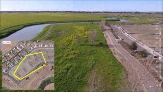
Salton Sea, CA
Salton Sea is one of project sites. The view at Salton Sea is absolutely stunning!
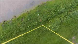
Flying Over Water
Capturing The Scenic View Over Water Using Phantom 4
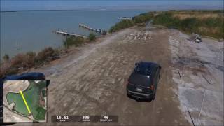
Flight Path Overlay
Overlaying Flight Path and map on the video taken By Phantom 4 Using Dashware software
Water Sampling
Using Phantom 4 and customized Payload (16oz Cup) to collect water sample from the lake.
3D Elevation Mapping
Creating 3D model for Tillage
bottom of page